
Drone Land Surveying for 100-Acre Development Sites Before Civil Plans Begin
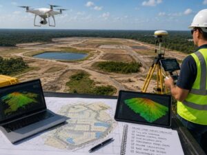
Drone land surveying changes the math on a 100-acre site. A ground crew working acre by acre can take weeks to finish. A drone can capture the same land in a matter of days, and civil engineers can start design work far sooner because of it.
This guide covers how drone land surveying supports large development sites before civil plans begin, and what developers should expect from the process.
Why Large Sites Change the Survey Math
Ground Crews Do Not Scale Well on Big Acreage
A ground survey crew collects data point by point. On a small lot, this works fine. On 100 acres, the same method means more days on site, more crew hours, and a longer wait before civil engineers get usable data.
Civil Engineers Need the Whole Site at Once
Civil plans for a large development rarely work well when built from partial data. Grading, drainage, and utility layout all depend on seeing the full site as one connected picture. A drone flight can capture the entire property in one pass, giving engineers a complete starting point instead of stitched-together sections.
What Drone Land Surveying Delivers on a 100-Acre Site
A Full Elevation Model of the Property
A drone survey produces a digital elevation model showing high points, low points, and grade changes across the entire site. This becomes the base layer that civil engineers use to plan grading and earthwork before any dirt moves.
Accurate Volume Data for Mass Grading
Large sites often need significant cut and fill work before construction starts. Drone data can calculate these volumes across the whole property, giving engineers a solid starting estimate for grading costs before plans are finalized.
A Base Map for Utility and Road Layout
Roads, utility corridors, and drainage systems all need to work together across a large site. A drone-based base map gives engineers a shared reference for laying out these systems in a way that fits the actual terrain, not just a flat paper plan.
Setting Up Drone Data for Civil Engineering Use
Matching Survey Accuracy to Design Needs
Civil engineering design work needs data accurate enough to support real construction decisions, not just a general site picture. Ask your provider what accuracy class their drone survey meets and confirm it matches what your engineering team requires for grading and utility design.
Using Ground Control Points for Accuracy
Drone imagery alone can drift slightly without reference points on the ground. A surveyor places ground control points across the site and ties the flight data to them. This step keeps the elevation model accurate enough for engineering design, not just a visual reference.
Delivering Files Engineers Can Actually Use
Confirm your provider delivers data in formats your civil engineering team already works with, such as CAD or GIS files. Raw drone imagery with no usable file format will slow down design instead of speeding it up.
How This Speeds Up the Civil Planning Timeline
Starting Design Work Sooner
Since a single drone flight can cover the whole site, civil engineers can begin grading and layout work almost as soon as the flight data is processed, instead of waiting on multiple rounds of ground survey data.
Reducing the Need for Repeat Site Visits
A full base map upfront reduces how often engineers need to request additional field data mid-design. This keeps the civil planning phase moving without repeated delays waiting on new survey information.
Supporting Phased Development Planning
Many 100-acre sites get developed in phases rather than all at once. Having full-site drone data from the start means each phase can be designed against the same base map, instead of ordering a new partial survey every time plans shift.
Questions to Ask Before Hiring for Large-Site Drone Surveying
- What accuracy class does their drone survey process meet?
- Do they use ground control points across the full site?
- What file formats will your civil engineering team receive?
- How do they handle flight coverage for irregular or wooded terrain?
- Can they turn around data fast enough to match your design schedule?
What This Means for Large Development Sites
Drone land surveying gives developers a fast, accurate way to map large sites before civil plans begin. On a property of 100 acres or more, this speed can shave real time off the early design phase and get engineers working with full-site data from day one.
Frequently Asked Questions
How much faster is drone land surveying compared to a full ground survey on 100 acres?
There is no fixed number since site conditions vary. However, drone surveys often reduce field time from multiple weeks to a few days on large open sites, with engineers able to start reviewing data much sooner.
Can drone data alone support final civil engineering design, or is ground survey still needed?
Drone data paired with ground control points can support most early design work, but boundary confirmation and some detailed design elements may still require targeted ground survey checks in specific areas.
Does dense tree cover affect drone survey accuracy on large sites?
Yes. Heavy tree cover can block the ground from view during a flight. Ask your provider how they handle wooded sections, since some areas may need supplemental ground data to fill gaps in the elevation model.
Can drone survey data be reused across multiple phases of a large development?
Yes, in most cases. A full-site drone survey completed early can serve as the base map for later phases, as long as site conditions have not changed significantly between phases.
What accuracy level should developers expect from a drone survey used for civil design?
This depends on the project, but civil engineering work typically requires a higher accuracy class than a general site overview. Confirm the specific accuracy standard with your provider and your engineering team before the flight is scheduled.
For a free land surveying quote, call us at (954) 519-7803 or send us a message by going here.
Posted in land surveying, land surveyor | Tagged Drone Land Surveying