
Why Surveyors Research Old Records Before Marking Property Lines
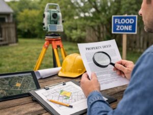
A property surveyor doesn’t just show up with equipment and start marking lines. Before any fieldwork begins, there’s a research phase that most property owners never see. That research is what separates a legally defensible boundary from a guess. Understanding why it happens can also help you avoid boundary problems that show up years after a survey is done.
Why Property Boundaries Are Built on History, Not Just Measurements
Every property line has a legal origin. It was created at a specific point in time, by a specific document, and recorded in a specific way.
A land surveyor’s task is to find that origin and honor it. That means going back through the records to understand how the property was first created, how it was divided over time and what descriptions were used along the way.
Modern equipment measures distance and angles with high accuracy. But it can’t tell you what a boundary was intended to be. Only the historical record can do that.
A deed written in the 1960s may reference a monument that no longer exists. A subdivision plat from decades ago may use reference points tied to landmarks that have since been removed. Without researching those records, a surveyor marking lines today has no way of knowing where those lines were meant to be.
How Old Deeds and Plats Can Reveal Missing Information
Deeds and plats are the primary documents a land surveyor reviews before any field visit.
A deed contains the legal description of the property. That description defines the boundary in words, often referencing distances, angles, monuments and adjoining owners. Older deeds sometimes include references that aren’t immediately obvious, like a corner tied to a now-removed fence post or a tree that no longer stands.
Plats are the recorded maps of subdivisions. They show how a large tract was divided into individual lots, where roads were dedicated and where easements were placed. When a surveyor reviews the plat for a residential lot, they can see how the entire subdivision was laid out and where the subject lot fits within it.
Together, deeds and plats give the surveyor a picture of the property’s full legal history. That picture guides every decision made in the field.
Why Surveyors Examine Neighboring Properties Along With Your Own
A single property doesn’t exist in isolation. Its boundaries connect directly to the properties around it.
A land surveyor often reviews the deeds and prior surveys of adjacent lots as part of the research process. This is where conflicts between properties become visible before the fieldwork starts.
An adjoining deed may describe the shared boundary line differently than your deed does. A prior survey on the neighboring lot may have placed a monument that doesn’t match the position your deed would suggest. Those conflicts need to be identified and evaluated before any lines get marked.
Skipping this step is how surveyors produce results that look correct on paper but create disputes the moment a neighbor reviews them. Reviewing adjacent records lets the surveyor find those inconsistencies early and decide how to resolve them based on the full picture.
When Physical Features on the Ground Conflict With Written Records
Fences, walls and driveways don’t always sit on legal property lines. Many were built without a survey. Some were placed by agreement between prior owners. Others simply ended up in the wrong place.
When a land surveyor arrives on site and finds that a long-standing fence doesn’t match the position the deed research suggests, that’s a conflict that requires careful evaluation.
The surveyor has to weigh the written record against the physical evidence. How old is the fence? Is there documentation of an agreement between prior owners? Have both sides treated that fence as the boundary for decades?
These questions matter because the answer can affect where the legal line sits. In some cases, the deed controls. In others, long-term occupation and use becomes relevant. The surveyor’s research is what provides the context needed to make that call correctly.
Physical features alone are never enough. The written record is always part of the analysis.
How Historical Research Helps Prevent Boundary Disputes Later
A boundary dispute is expensive. It involves attorneys, additional surveys and sometimes court proceedings. Most disputes share a common root: someone made a decision about a property line without enough information.
When a land surveyor does thorough record research before marking lines, the result is a boundary position that can be explained and defended. Every decision traces back to a document. Every line position has a reason tied to the recorded history of the property.
That documentation matters when a neighbor questions the result. It matters when a title company reviews the survey for a sale. It matters when a permit office asks how the boundary was determined.
Surveys built on thorough research hold up. Surveys built only on field observations and current documents often don’t, especially when older conditions come to light later. The research phase is what gives the final result its legal foundation.
Frequently Asked Questions
Why do surveyors spend so much time researching old records?
Property boundaries are legal in nature. They were created by historical documents and can only be accurately located by understanding those documents first. A land surveyor reviews old deeds, plats and prior surveys to understand how a boundary was originally created before confirming its location in the field.
Can modern GPS equipment replace deed research?
No. GPS measures location with high accuracy, but it has no knowledge of what a boundary was intended to be. A deed may describe a line tied to a monument that no longer exists. Without researching that deed, GPS equipment has nothing legally meaningful to measure from. Equipment and research work together, but neither replaces the other.
Why do surveyors review neighboring properties?
Shared boundary lines appear in the records of both properties. A surveyor who reviews only one side of a shared line may miss conflicts that only become visible when both deeds are compared. Adjacent surveys can also contain monuments and measurements that are relevant to the subject property’s boundaries.
What happens when fences and records do not agree?
The surveyor evaluates both sources. The age of the fence, the existence of any prior agreements between owners and how long both parties have treated the fence as the boundary are all relevant factors. In some cases the deed controls. In others, long-term use affects the legal outcome. The written record always forms part of the analysis.
How does historical research help avoid future disputes?
A boundary position supported by thorough research can be explained with documentation. When a neighbor, title company or permit office questions the result, every decision traces back to a specific record. That traceability is what makes a surveyed boundary defensible and reduces the likelihood of a dispute arising later.
For a free land surveying quote, call us at (954) 519-7803 or send us a message by going here.
Posted in land surveying, land surveyor | Tagged cost of land surveying, estimating the cost of land surveying, land surveying cost, land surveying cost Miramar